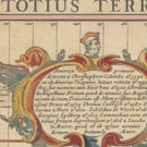
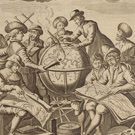
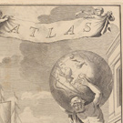
Sea Atlases
A selection of atlases from the Harvard Map Collection.

As long as people have ventured out in ships and exposed themselves to the vagaries of wind and tide, they have endeavored as much as possible to minimize the risks of life at sea. The earliest mariners, of course, relied upon the oral transmission of instructions about the hazards of navigation, methods of orientation, and anchorages along particular routes. The ancient Greeks and Romans often codified those details in manuscript logs (peripli), which listed sequentially the distances between ports and landmarks along coastal routes. With improvements in the technology of orientation and navigation in late medieval Europe, these textual guides evolved into portolan charts which offered graphic tools for laying down a course and following a coastal itinerary. Beginning in the late 16th century, the nascent cartographic publishing industry found a receptive market for pilot books and sea atlases, which provided collections of detailed charts and sailing directions for the most frequently traversed routes. In the following pages we will introduce some of the most influential of these early guides to the realms of Neptune.

The Atlases

Waghenaer atlas sample

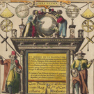
Du miroir de la navigation
(1590)

Waghenaer, Lucas Janszoon

A general map of Europe’s west coast as well as 47 detailed charts, ranging from Cadiz in the south to the White Sea in the north

Blaeu atlas sample

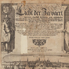
The light of navigation
(1623)

Blaeu, Willem Janszoon

Detailed instruction on celestial navigation; 41 charts for orientation to the coasts of the Netherlands, France, Spain, Portugal, the British Isles, Norway, the Baltic Sea, and North Sea

Colom atlas sample

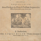
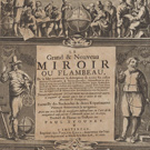
L’ardante ou flamboyante colomne de la mer
(1633)

Colom, Jacob

42 charts covering the navigation from the White Sea and Baltic to the Straits of Gibraltar

Dudle atlas sample

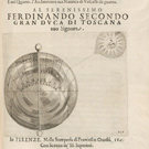
Dell’ arcano del mare
(1646)

Dudley, Robert, Sir

First printed English atlas of nautical charts covering all parts of the known world; it pioneered in the use of the Mercator projection

Wit atlas sample

Dutch sea atlas
(1654)

Wit, Frederik de

Small sea atlas, ranging from Spitzbergen in the north to the Cape of Good Hope in the south; it includes coasts of western Europe as well as western and southern Africa, the Caribbean and the east coast of North America, southeast and east Asia

Goos atlas sample

Le grand & nouveau miroir ou flambeau de la mer
(1662)

Pieter Goos

Reproduced here the first two parts focus on the western and northern navigation, including the British Isles, the Netherlands, France, the Iberian Peninsula, and the Canary Islands

Keulen atlas sample

De nieuwe groote lichtende zee-fakkel
(1734)

Keulen, Gerard van.

In its time the most comprehensive pilot book available. The two volumes displayed here focus on the Baltic and the North Sea, the British Isles, the Channel, the Iberian Peninsula, and the Canary Islands

Renard atlas sample

Atlas van zeevaert en koophandel door de geheele weereldt
(1745)

Renard, Louis

This atlas was intended for actual use at sea as well as armchair consultation; although it only contains 32 charts, it offers global coverage from pole to pole, including the coasts of Africa, Asia, and the Americas

Acknowledgments

This sea atlas viewer was made possible through the generous support of William B. (BA ‘66, PhD ‘71) and Inger Ginsberg. Mr. Ginsberg is a longtime supporter of the Harvard Libraries and is the author of many cartobibliographies, including most recently Sea Charts of Norway (2012). Valuable contributions of time and effort were also provided by the Pforzheimer Fellowship Program.

We would like to thank Joseph Garver, Whitley Frost, Andrew Lorey, Enrique Diaz, Jeremy Guillette, and Heng Du for their efforts in the creation of this exhibition.